This is the route from Bishkek in Kyrgyzstan via Osh to Khorog in Tajikistan. When we rode this our intended route back North into Kyrgyzstan was closed to foreigners so we returned back up the Pamir Highway all the way to Bishkek. One way is about 700km long.

Showing posts with label Pamir Highway. Show all posts
Showing posts with label Pamir Highway. Show all posts
22/09/2009

02/06/2008
31/05/2008
We've cycled the Pamir Highway
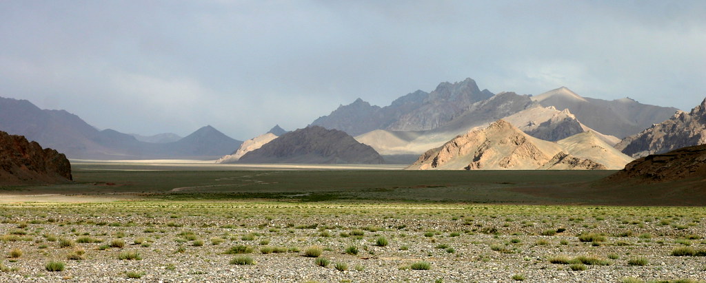
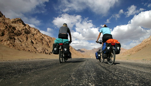
We've spent the last 5 weeks cycling around Kyrgyzstan and Tajikistan in Central Asia. They're amazing countries - sort of a cross between Mongolia/Nepal and Afghanistan. Yurts everywhere in Kyrgyzstan and not much at all in Tajikistan.
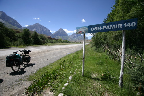
We'd read about some roads that are worth cycling and the Pamir stood out - there's also the Karakoram highway and the Friendship Highway in Tibet but this looked really exciting - 750km long, camp where you want, nobody lives there and mostly above 4000m!
30/05/2008
Cycling in Kyrgyzstan and Tajikistan - Pamir Highway Road Guide for cyclists
This guide is from Betzgi's fantastic website and is formatted for easy printing en route.
19/02/2008
GPS File - Pamir Highway
The file below is of our route South from Bishkek to Khorog.
We had to ride back to our starting point because the border crossing to Kyrgyzstan that we wanted to use was closed to foreigners.
We got to 'Yo-yo' the Pamir Highway and camp in all the good spots that we missed on the way South:
This was the best campsite EVER and is in the Lonely Planet coffee table book - 'The Big Trip'

We had to ride back to our starting point because the border crossing to Kyrgyzstan that we wanted to use was closed to foreigners.
We got to 'Yo-yo' the Pamir Highway and camp in all the good spots that we missed on the way South:
This was the best campsite EVER and is in the Lonely Planet coffee table book - 'The Big Trip'
01/09/2007
Osh to Bishkek
When we finished the Pamir we still had to cycle the 762km between Osh and Bishkek. It took us just over 5 days and we really did some cycling. Several days we did between 130km and 150km and on the last we managed 165km. It was just getting easier and easier even though we were still climbing huge amounts. The worst day of the cycle was 69km continually uphill, with not even one small bit of downhill, climbing 2200m. This took us from Toktokul up to the first of the big passes before Bishkek. We even had to cycle 3km through the tunnel that shortens the final pass before Bishkek. The air was not brilliant and we were lucky to be cycling slightly down hill through it. After the tunnel we had an amazing drop of 2500m and some of the fastest roads that we cycled on all journey.
31/08/2007
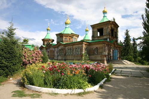
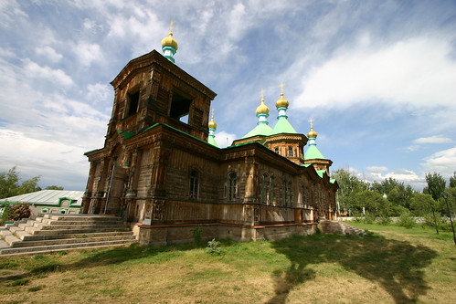
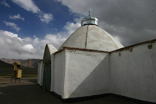
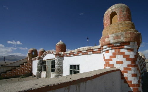
Places of Worship in Kyrgyzstan and Tajikistan
Karakol Russian Orthodox Church
Karakol Chinese Mosque

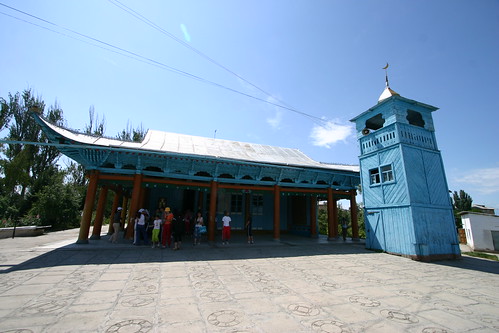
Alichur Mosque and Murgab Mosque
Karakol Chinese Mosque
Alichur Mosque and Murgab Mosque
Blogged with Flock
30/08/2007
23/08/2007
What the hell is nonkoph?

The woman whose homestay we stayed at had a great NONKOPH machine - kids kept coming round to use it. Unfortunately we kept missing out although she gave us some when we left.
Her garden was full of fruit trees - apples, apricots and cherries. It was actually dangerous to sit around so much fruit was falling off.
22/08/2007
Marco Polo Sheep popular round here
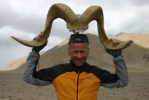
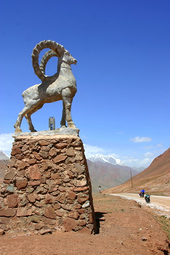

Marco Polo sheep
From Wikipedia, the free encyclopedia
Marco Polo sheep (Ovis ammon polii) is a subspecies of sheep, specifically of Argali, that takes its name from famed explorer Marco Polo. The Marco Polo sheep is particularly known for its long horns. The longest horn ever found on a sheep was found on a Marco Polo sheep and measured 191 centimeters (75 inches)[1]. The Marco Polo sheep is endangered, numbering only 6,000.[2] Marco Polo sheep are found only in the Pamir Mountains in the border region of China, Afghanistan, Pakistan and Tajikistan. Some of the protected areas where the species occurs include the Khunjerab National Park and Central Karakoram National Park in northern Pakistan and the Taxkongau Nature Reserve in southwestern China. The Wildlife Conservation Society is trying to organize a protected area for the sheep of about 50,000 square kilometers (20,000 square miles) straddling the four borders.20/08/2007
The Pamir Highway
From Wikipedia, the free encyclopedia
The Pamir Highway (Russian: "Pamirsky Trakt", Памирский тракт) is a road traversing the Pamir Mountains in Central Asia. Sources disagree on the termini of the highway, with Mazari Sharif, Afghanistan; Dushanbe, Tajikistan; and Khorog, Tajikistan all being offered as the beginning of the highway; however all sources agree that the Pamir Highway ends in Osh, Kyrgyzstan. The Pamir Highway is designated as route M-41 over much of its length in Tajikistan, and is known as the second-highest altitude international highway in the world (4,655 m). It has been given the European route number E 008 between Dushanbe and Murgab, but not between Murgab and Osh, because of the unreliability of the highest part. Tajikistan etc have got E-roads (around 2001) since they have become members of the UNECE.
Despite being called a highway, the road is only sparsely maintained, sometimes paved but often a dirt road, and heavily damaged in places by erosion, earthquakes, landslides, and avalanches. However, it is the only continuous route through the difficult terrain, serving as the main supply route to Tajikistan's Gorno-Badakhshan Autonomous Region. The route of the Pamir Highway has been in use for millennia, as there are a limited number of viable routes through the high Pamir Mountains; the road formed one link of the ancient Silk Road trade route. The quality requirements for an E-road is among others, paved, at least 8 m wide, at most 8 % grade, but they do not seem so stringent.
 The road begins just east of Mazari Sharif in northern Afghanistan, passing northward into Uzbekistan before turning east and crossing another border into Tajikistan. It then follows a general eastward route through Dushanbe, the capital of Tajikistan, to Khorog, crossing the Kafirnigan, Vakhsh, and Bartang Rivers. From there it continues east for a distance of 311 kilometers (193 miles) to Murghab, there crossing the Murghab River before turning northward. The Pamir Highway passes through the altitude 4,655 meter (15,270 ft) Ak-Baital pass and past lake Kara-Kul before crossing into Kyrgyzstan and on to Osh. The Murghab-Osh leg is 417 kilometers (259 miles) in length. The stretch of road between Khorog and Osh attracts some small amount of tourism due to its rugged, unspoilt natural beauty and sparse but friendly native population.
Subscribe to:
Posts
(
Atom
)